Re-posted from 4/3/2025, Dave Brook
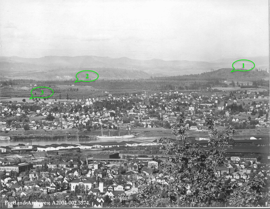
The panoramic photograph is of NE Portland in 1903. It was taken just before the Sullivan's Gulch and Irvington were developed. The view is It's part of a bigger panorama of Portland taken by courtesy of local historian Doug Decker.
First a little orientation: - Point 1 is Rocky Butte
- Point 2 is on the Alameda Ridge, with just a few structures on it — probably farms
- Point 3. This open area is farm land that was on a trajectory to be part of the broader Irvinginton development, but not yet subdivided on the ground. Doug Decker says, it's bordered by today’s NE Thompson-Fremont between 7th and 15th. This may have been used by the Multnomah Fair Association for various activities.